Sunday, September 15, 2013

Forest Park, Hike 26

Ever since I shifted from walking to running, I haven't had much to post here. Then, a few months back, I rediscovered Forest Park and it's many, many miles of trails (80 miles in all, if you count all the side trails and firelanes). I've found that a mix of running and walking/hiking works best, as about half the trails are fairly flat, while others (especially the firelanes!) are quite steep. The soft ground is great for the feet and knees, but one must be careful, as I've tripped more than once on some of the roots growing across the trails.

I've been starting to work my way through a wonderful book called One City's Wilderness, Portland's Forest Park and have officially completed eight of them. I've been going at it randomly, based on how I feel that day: Steep or flat, long or short, close-to-city or farther north... Today was Hike 26: Firelane 5, Leif Erikson Drive, Cleator Trail, Wildwood Trail, and Saltzman Road Loop (4.1 miles), listed as moderate with a 413 foot cumulative elevation gain.

Starting at the Saltzman Road Trailhead, I parked my car and started down Firelane 5, first wide and gravelly but soon more earthen and "natural," passing a nice lookout point with emerging fall colors, and eventually connecting with Leif Erikson Drive, where I walked past an interesting looking, now abandoned water tank that used to be available for fighting wildfires but now is a spectacular habitat for ferns.


After proceeding along Leif Erikson Drive for about a mile, passing under some mossy fallen trees, I turned sharply to the right up steep Cleator Trail.


At the intersection of Wildwood Trail and Saltzman Road, I was suddenly taken by the absolute stillness, and silence, of the spot. I pulled out my camera and tried to capture what it looked and felt like. (Sorry, but camera phones just can't do it justice).


I then turned up Saltzman Road and walked for about another mile before returning to my car, a bit tired but quite refreshed. A nice way to spend an hour and a half on a Sunday afternoon!

Friday, February 24, 2012

Gimme (Marquam) Shelter

In answer to the question "What did you do before the game on Superbowl Sunday?" here you go. (I know...everybody's been asking!)

I drove up to Hillsdale on Capitol "Highway" and took a left on Terwilliger. As the road wound down the hill toward OHSU, with a walking/jogging sidewalk on the right, I scanned left to see if there were any entrances to possible hiking trails. Sure enough, about a mile or so I saw it:

The sign said (only) 1.7 miles to the shelter, which seemed like a nice destination point, making my intended round trip a "simple" 3.4 miles. As it turned out, there were a few hills along the way that made it a bit more strenuous than planned. (Guess that's why they call it the West Hills, eh?) But anyway, car parked at the side of the road, I headed in, soon coming to a rickety wooden bridge, making my way up some winding paths and eventually coming to a nice bench upon which to rest (where I got my first mosquito bites of the year!), then finally to a trail leading up to Marquam Hill Road, at about 0.9 miles toward the search for shelter.


Just across the road, I came to Marquam Reservoir No. 2, and made my way down a fairly steep and quite rocky wide trail, eventually coming to the Shelter.


I can't find much info on the Marquam Shelter online, but it is a nice respite for hill-fatigued hikers.

Rested at the halfway point, I turned up the steep rocky slope and started back. Again crossing Marquam Hill Road, I enjoyed going DOWN the winding trails and crossing a bridge with truly crooked stairs, taking in all the green moss, vines and ferns while breathing the fresh oxygen that they provided. The sunshine filtering through the trees made for a nice semi-shaded, semi-sunny trek.


And so, back to the car, and back home to watch the big game. Too bad the Patriots didn't win it (again), but after this lovely outdoor experience, I couldn't get too down. I've since done the hike again (faster this time; getting in better shape), and it was still fun, with soft paths and negligible mud - not bad for February in Portland!

Wednesday, May 4, 2011

Walk 50: Powell Butte (4 miles)

First, a confession: This final walk wasn't one of the official 50 of the Walk There book, but it was mentioned in the back in a section titled "More Great Places to Walk." The actual (50th) walk was "Route Two" of Walk 17, of the Springwater Corridor Trail. I found myself near it during Walk 31, and since it was along the way I covered this distance of the trail. But since this section of the Springwater Trail had been so uninspiring, I didn't really want to make a whole separate post about it. So, Powell Butte it was, thanks to the suggestion of good friend Amy C.

The entrance to Powell Butte was at SE 162nd Avenue, immediately off Highway 26 in Gresham. It was raining during the drive out there, but as I had planned it (wink), the rain stopped and we had sunny weather the whole walk.

I say "we" because I was joined by my lovely wife Lisa this special day.


The paved trail led up a gentle slope toward the top of the butte. Looking back, we were treated to a beautiful panoramic view miles in each direction. The clouds were just high enough to see many of the surrounding buttes and peaks.


The path looped around until we spotted a turnoff to a lesser used trail heading toward a wooded area. My motto: Always head for the path less traveled (if it doesn't look too treacherous).


Lots of green was to be seen, and mixed shade/sun made for a very pretty and relaxing walk. My favorite sights, though, were the interesting ways the older trees had died and fallen:


After a mile and a half or so, the trail led back out and up toward the top of the butte again, where we came across a set of wooden pointers, each labeled with a physical landmark (like Mt. Hood or Larch Mountain, for example) and the distance to it.


Sooo clever the way the "e" from Gresham Butte had been worn away...


As we made our way back to the car, I spotted a possible source of some of the large piles of poop we had stepped around along the trails.


And that's that. Fifty walks in approximately six months. I plan to keep walking, but probably won't blog about it so much, at least until I come up with another theme.

So, until next time, keep putting one foot in front of the other, and always look in the direction you're going! (Or else you might have a nice trip...badum.)

Saturday, April 30, 2011

Walk 49: Milwaukie/Oak Grove Trolley Trail (8 miles)


This long walk sounded pretty cool at first: It traveled a former trolley line that existed from 1893 to 1968 (the last 10 years as a freight service), and I could trace the history of the trolley as I made my way along the 4 miles each way from Milwaukie to Oak Grove.

The trail began at SE McLoughlin Boulevard and Park Avenue, getting off to an inauspicious start by passing an auto body yard with some trashed police cars and an unmarked narrow trail that I wasn't sure was the Trail or not...


But before long I came to a sign that assured me I was on the right "track."


The trail soon led out onto Arista Drive (no relation I assume to the record label which brought us the Alan Parsons Project, among others). The road was under construction, so no sidewalk along this section, and I had to alternate from side to side to avoid various large equipment and traffic.

The book explained that I was passing by various historical landmarks like notable trolley stations, a sanitarium and a general store, but little evidence remained of these interesting spots now.


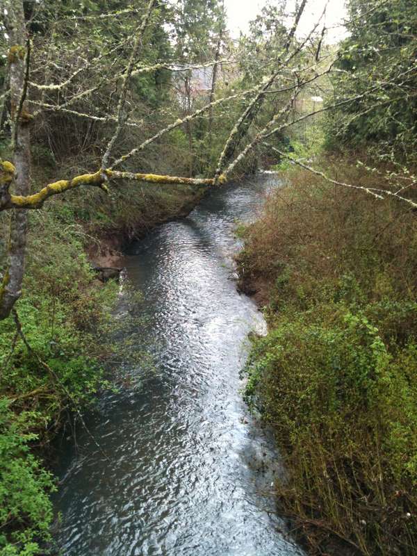
Unfortunately, as the Trail picked up again, things didn't improve much, as the ground was somewhat muddy and chewed up.


At Rupert Drive, an approximately 15 foot stretch of trolley tracks surfaced. It turned out that this was the only visible evidence of the actual tracks along the entire trail. That was a bit of a letdown!


It was there I discovered that the ground was being actively dug up, which I soon realized was part of a major construction to convert the entire trail into a biking/pedestrian path. Bad timing on my part! At this current moment it was a long, rocky and muddy terrain, forcing me to move off to the side roads for long stretches. Judging by this artist's rendition, it will be quite lovely when it's completed. Can't tell if it'll be paved or not, though.


The road however eventually came to a stop and I was back on the path, which then passed between some closely packed housing (and trailers), then leading to a narrower, but nicer, gravel/grassy path, and finally again out to paved streets with, for the first time, a sidewalk, although this one was a little wobbly.


The turnaround point came at Glen Echo Avenue, at Camp Fire USA. (Headquarters? A quick Google search just turns up "Retreat Center."


Well, this walk was more than a bit melancholy. Eight miles total and only about 15 feet of the original tracks still visible. As the line has been discontinued for only 43 years, I would've thought more of it would still be apparent. I felt like the boy from Ray Bradbury's Martian Chronicles, who asks "Where are the Martians?"

The truth is, the trolley trail isn't really here anymore, and when the construction is complete, the trail will be something new and different; something of the 21st century.

Tuesday, April 26, 2011

Walk 48: Butler Creek Greenway Trail, Gresham (3 miles)

Last of the eastside walks from the book, although I plan to do one more "non-book" one at Powell Butte before I finish blogging these.

This one started at a trail off Binford Avenue, and meandered past creeks, over little bridges and led to the reflective and quiet Binford Lake.


Walking past this lake, I then came to the centerpiece of the walk, a large pond (or small lake?) at Butler Creek Park. I could see the willow tree from all sides as I walked around it. Truly scenic and relaxing.


As I left the park, the walk proceeded along local streets, past this English imported traffic device and eventually back to the starting point.


Just past the start/end point, I turned off on another path which crossed over the much grander Johnson Creek, until I met up with the Springwater Corridor Trail, which I'd been on in earlier walks. Here, I turned around and headed back to the car.


Ah, Binford Avenue. Reminded me of my first cat, Binky, who also went by the more formal name of Binford. He lived to the ripe old age of 18. Memories...


Sunday, April 24, 2011

Walk 47: Portland Heights to Zoo (5.5 miles)

Walk 47 started at SW 18th and Jefferson, headed up 18th and under Highway 26, and took an immediate left along I-405. Loved the typical Portland graffiti exhorting us (someone in particular?) to "make things better."


Heading up Vista Avenue, I was treated to a great view of downtown Portland with Mt. Hood in the distance. What a lucky break to have such great weather this day!


As I made my way up 18th Avenue, I read in the book that there had been a cable car along this very steep road back in the late 1800's. After "several runaway crashes" it was discontinued in 1903. I can just imagine how terrifying a ride that would have been! It was replaced later by the Council Crest streetcar, which ran until the 1950's.


Up Spring Street, I passed Ainsworth Elementary School, notable for a couple of "Auction Winner" parking spaces up front, and an artificial turf soccer field permanently installed on the playground. Very nice.


Leaving Ainsworth, I crossed a 60-meter pedestrian bridge, looking down for a quick rush of adrenaline (and a bit of vertigo). I'm always good for a cheap thrill...


I then headed again up picturesque Montgomery Drive, eventually passing a house who's yard reminded me of an Italian villa/vineyard:


Turning right on Patton, I proceeded past Strohecker's/Lamb's, which has been there for over 100 years. I now know what attracts 'em in Portland Heights...


Then came a sharp right turn onto the Marquam Trail toward the Zoo. I had come up from this trail in the opposite direction on an earlier walk (38, the '4T'), so things were starting to look familiar now.


After the trail took me up to the Zoo and the Max stop, I descended in the elevator to 800 feet below the surface, where they preserved some lava that was drilled out of the Sylvan Hills ("boring" lava, though I found it mildly interesting).


As I rode the Max back to my starting point, I noticed a gentleman with a cowboy hat made from an 18-pack Rainier beer box. I pointed my camera toward the middle of the train, trying not to be obvious, but as I snapped the pic, he flashed a sideways peace sign. Cool, dude.