Showing posts with label Trail. Show all posts

Wednesday, May 4, 2011

Walk 50: Powell Butte (4 miles)

First, a confession: This final walk wasn't one of the official 50 of the Walk There book, but it was mentioned in the back in a section titled "More Great Places to Walk." The actual (50th) walk was "Route Two" of Walk 17, of the Springwater Corridor Trail. I found myself near it during Walk 31, and since it was along the way I covered this distance of the trail. But since this section of the Springwater Trail had been so uninspiring, I didn't really want to make a whole separate post about it. So, Powell Butte it was, thanks to the suggestion of good friend Amy C.

The entrance to Powell Butte was at SE 162nd Avenue, immediately off Highway 26 in Gresham. It was raining during the drive out there, but as I had planned it (wink), the rain stopped and we had sunny weather the whole walk.

I say "we" because I was joined by my lovely wife Lisa this special day.


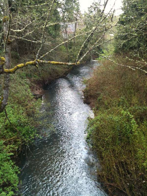
The paved trail led up a gentle slope toward the top of the butte. Looking back, we were treated to a beautiful panoramic view miles in each direction. The clouds were just high enough to see many of the surrounding buttes and peaks.


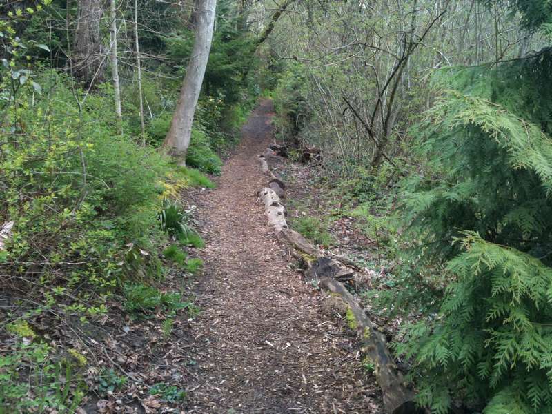
The path looped around until we spotted a turnoff to a lesser used trail heading toward a wooded area. My motto: Always head for the path less traveled (if it doesn't look too treacherous).


Lots of green was to be seen, and mixed shade/sun made for a very pretty and relaxing walk. My favorite sights, though, were the interesting ways the older trees had died and fallen:


After a mile and a half or so, the trail led back out and up toward the top of the butte again, where we came across a set of wooden pointers, each labeled with a physical landmark (like Mt. Hood or Larch Mountain, for example) and the distance to it.


Sooo clever the way the "e" from Gresham Butte had been worn away...


As we made our way back to the car, I spotted a possible source of some of the large piles of poop we had stepped around along the trails.


And that's that. Fifty walks in approximately six months. I plan to keep walking, but probably won't blog about it so much, at least until I come up with another theme.

So, until next time, keep putting one foot in front of the other, and always look in the direction you're going! (Or else you might have a nice trip...badum.)

Saturday, April 30, 2011

Walk 49: Milwaukie/Oak Grove Trolley Trail (8 miles)


This long walk sounded pretty cool at first: It traveled a former trolley line that existed from 1893 to 1968 (the last 10 years as a freight service), and I could trace the history of the trolley as I made my way along the 4 miles each way from Milwaukie to Oak Grove.

The trail began at SE McLoughlin Boulevard and Park Avenue, getting off to an inauspicious start by passing an auto body yard with some trashed police cars and an unmarked narrow trail that I wasn't sure was the Trail or not...


But before long I came to a sign that assured me I was on the right "track."


The trail soon led out onto Arista Drive (no relation I assume to the record label which brought us the Alan Parsons Project, among others). The road was under construction, so no sidewalk along this section, and I had to alternate from side to side to avoid various large equipment and traffic.

The book explained that I was passing by various historical landmarks like notable trolley stations, a sanitarium and a general store, but little evidence remained of these interesting spots now.


Unfortunately, as the Trail picked up again, things didn't improve much, as the ground was somewhat muddy and chewed up.


At Rupert Drive, an approximately 15 foot stretch of trolley tracks surfaced. It turned out that this was the only visible evidence of the actual tracks along the entire trail. That was a bit of a letdown!


It was there I discovered that the ground was being actively dug up, which I soon realized was part of a major construction to convert the entire trail into a biking/pedestrian path. Bad timing on my part! At this current moment it was a long, rocky and muddy terrain, forcing me to move off to the side roads for long stretches. Judging by this artist's rendition, it will be quite lovely when it's completed. Can't tell if it'll be paved or not, though.


The road however eventually came to a stop and I was back on the path, which then passed between some closely packed housing (and trailers), then leading to a narrower, but nicer, gravel/grassy path, and finally again out to paved streets with, for the first time, a sidewalk, although this one was a little wobbly.


The turnaround point came at Glen Echo Avenue, at Camp Fire USA. (Headquarters? A quick Google search just turns up "Retreat Center."


Well, this walk was more than a bit melancholy. Eight miles total and only about 15 feet of the original tracks still visible. As the line has been discontinued for only 43 years, I would've thought more of it would still be apparent. I felt like the boy from Ray Bradbury's Martian Chronicles, who asks "Where are the Martians?"

The truth is, the trolley trail isn't really here anymore, and when the construction is complete, the trail will be something new and different; something of the 21st century.

Tuesday, April 26, 2011

Walk 48: Butler Creek Greenway Trail, Gresham (3 miles)

Last of the eastside walks from the book, although I plan to do one more "non-book" one at Powell Butte before I finish blogging these.

This one started at a trail off Binford Avenue, and meandered past creeks, over little bridges and led to the reflective and quiet Binford Lake.


Walking past this lake, I then came to the centerpiece of the walk, a large pond (or small lake?) at Butler Creek Park. I could see the willow tree from all sides as I walked around it. Truly scenic and relaxing.


As I left the park, the walk proceeded along local streets, past this English imported traffic device and eventually back to the starting point.


Just past the start/end point, I turned off on another path which crossed over the much grander Johnson Creek, until I met up with the Springwater Corridor Trail, which I'd been on in earlier walks. Here, I turned around and headed back to the car.


Ah, Binford Avenue. Reminded me of my first cat, Binky, who also went by the more formal name of Binford. He lived to the ripe old age of 18. Memories...


Sunday, April 10, 2011

Walk 44: Westmoreland to Crystal Springs to Reed College (5 miles)

This walk had not one but two distinct human-made "natural" areas, both to which I'd never been, but was happy I finally did!

This walk started at SE 17th Avenue and Bybee Boulevard in the Westmoreland neighborhood of Portland. I headed east, crossing train tracks and the Bybee Bridge, traveling alongside the Eastmoreland Golf Course. I couldn't decide whether it was nice, or cruel. Kept thinking how much I'd like to get out there on the links!


I arrived at the Crystal Springs Rhododendron Garden, and paid the $3 admission fee (free on Tuesdays and Wednesdays but this was a Sunday). The price was totally worth it, based on the sights and smells of the place. I spent a good 45 minutes wandering around, relaxing quite a bit in spite of my haste to complete the walk and get home in time for dinner.


If you like ducks (and geese), this place has LOTS of them. I caught these two napping near a gently trickling waterfall. Nice day for it!


I left Crystal Springs feeling somewhat rejuvenated, and continued on SE 28th Avenue to Reed College, where I found my way to a path that went a long way around a creek, lake and springs. It was really nice back there, and there were very few people on the paths to disturb the reverie.


I left the trail and walked up to the college for a quick look around. Didn't see much - again, was trying to get back home in time to make food for the kids - but I did see some nice old buildings, well maintained campus grounds, and a cool outdoor amphitheater in front of the creek. I could just see them doing Shakespeare in this setting.


Starting back, I passed this fruit stand, and enjoyed some "berry good" fresh strawberries and plums.


As I returned to my car, I saw quite a queue across the street for Saburo's. Must be pretty good sushi in that place!


A very nice mid-distance walk. The best part was definitely the Crystal Springs garden. It's quite large, and I could easily spend a couple hours there with a sketch book, drawing or writing. Matter of fact, I'm pretty sure I'll be back.

Tuesday, April 5, 2011

Walk 42: Fanno Creek Greenway Trail, Tigard (5+ miles)

Nice mid-length walk, mostly nature views, but surprise! Another library on the way. More on that later.

This walk started at Englewood Park, just off Scholls Ferry Road near Hwy 217. Lots of views of Fanno Creek, marshes, grassy areas, ducks and of course, the obligatory moss covered building.


I liked this sign. Humor is a good way to get a message across:


After about 2-plus miles, I crossed Hwy 99 and walked down Main Street into Tigard.


The sun was shining and I'm sorry but the iPhone didn't catch the beauty of the sun streaming through a tree very well, but it is what it is...


More creeks followed.


And then, whoops, I found myself at another public library. Time to look for some more CDs! And wouldn't you know, a donut shop is in this one. I was good, though, and only had a banana. A weird surge of self-control. Must've been the exercise thing kicking in.


I then did a 180 and headed back through Tigard, returning up through the long and winding trail...


Ah, the sights of spring!